|

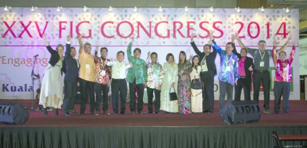
XXV FIG Congress- a celebration, celebrating the culmination of collective
efforts and collaborative actions
"The FIG Congress is our global forum where sciences, technologies,
knowledge and practices come together; where issues, initiatives, researches
and results converge and where cultures, diversity, specialization and
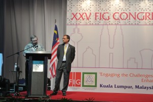
expertise assemble"; said FIG President Teo CheeHai, at the opening
ceremony of the Congress.
|
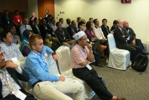
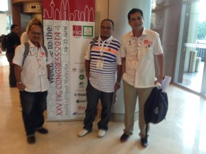
The FIG Congress - where young and experienced meet
Here the FIG Foundation board of Directors and Trimble
representative Keith Hofgartner, together with the 8 Young Surveyors
who were selected to participate from all parts of the world. |
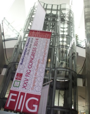
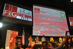
The FIG Congress was for the first time since its beginning in1878 held
in Asia, and the silver jubilee Congress was a culmination of the four-year
FIG Work Plan for the current FIG Council as well as the start of a new 4
year term with a new FIG President and two Vice Presidents elected at the
General Assembly.
Since Kuala Lumpur, Malaysia was selected as destination for the 2014
Congress, the Local Association, PEJUTA, the Local Organising Committee and
FIG have worked intensely on the preparations to make this Congress a
special experience for all participants. This culminated from 16-21 June in
a mix of sessions, events, tours and impressions. The Congress offered more
than 170 technical sessions over the four Conference days with around 550
presentations, a welcome reception for all attendants, 3-day exhibition,
technical tours, social tours, a Malaysian dinner and Gala dinner. Partners
were the World Bank, FAO, UN-ESCAP, UN-GGIM, UN-Habitat/GLTN. The Congress
attracted more than 2500 participants from almost 100 countries.
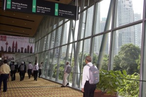
Kuala Lumpur and Malaysia is a wonderful destination for a conference.
The Malaysian hosts showed their hospitality and did their utmost to welcome
all the international and national participants and make them feel
comfortable right from the arrival at the airport to the Kuala Lumpur
Convention Centre where the Congress took place. The centre is conveniently
placed in the centre of Kuala Lumpur and is easy to access. From the centre
there is a wonderful view toward the Petronas Towers – one of the remarkable
landmarks of Kuala Lumpur.
 |
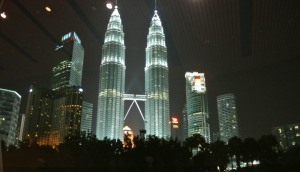
The view from the Kuala Lumpur Convention Centre |
This Congress was co-organised between FIG and the Association of
Authorized Land Surveyors Malaysia, PEJUTA with he cooperation from Land
Surveyors Board Malaysia, Department of Survey and Mapping Malaysia,
Malaysia Convention & Exhibition Bureau, Board of Quantity Surveyors,
Malaysia, Board of Valuers, Appraisers and Estate Agents Malaysia, City Hall
of Kuala Lumpur and Royal Institution of Surveyors Malaysia. Primary
Supporters were Malaysia Convention & Exhibition Bureau, Malaysia (MyCEB),
Department of Survey and Mapping Malaysia (JUPEM) and Land Surveyors Board
Malaysia. A special thanks to all contributors, bringing this Congress to a
success.
The Congress was a celebration and culmination of the collective efforts
and collaborative actions taking place during the last four years, as FIG
President Teo expressed in his opening speech. Then the President said: ‘The
Surveying profession is a real world, people centric, solution-oriented
profession. It is a creative and constructive profession engaged in idea
generation, conceptualization and constructive development, engaging the
creative and innovative processes that generate new approaches and
opportunities, including that which has never before existed’.
The theme of the XXV FIG Congress ‘Engaging the Challenges, Enhancing
the Relevance’ could not have been chosen better. Not only a series of
impressive developments as the Global Geodetic Reference Frame, Global
Geospatial Information Management and GNSS World are under co-ordination for
implementation. Also a series of approaches and tools as for example
“Fit-for-Purpose” Land Administration and the Social Tenure Domain Model
demonstrate that FIG, together with its partners and the profession, are
ready to engage challenges as undernourishment, shelter, climate change and
economic progress with its sciences, technologies, knowledge and practices.
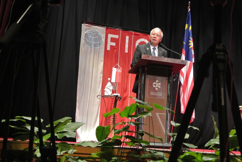
The world we want
‘Politicians and governments can do more to embrace the revolution in
data gathering and analysis; to use evidence-based policymaking to design
programmes that work. So too the surveyors who produce some of the most
important data of all’ said the Prime Minister of Malaysia, the
Honourable Dato’ Sri Mohd Najib bin Tun Haji Abdul Razak, in his opening
speech. He added: ‘We should work to improve existing information
infrastructure, including spatial data infrastructure; and to implement
policies to ensure that spatial data is reliable, accessible for re-use, and
can be easily integrated into collaborative environments’.
|

Prime Minister of Malaysia, the Honourable Dato’ Sri Mohd Najib bin
Tun Haji Abdul Razak giving his inspiring welcome address |
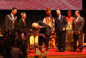
The Prime Minister of Malaysia testing his present
|
Key note speakers as Greg Scott and Vanessa Lawrence from the United
Nations Initiative on Global Geospatial Information Management referred to
the vision ’Realizing the Future We Want for All’, the first report of the
UN System Task Team on the Post-2015 UN Development Agenda from 2012. This
vision is very relevant for the profession and sets out four core dimensions
where progress needs to be made:
- Inclusive social development: including empowering people through land
tenure security
- Environmental sustainability: including improved land use planning and
food security
- Inclusive economic development: including ensuring access to land and
natural resources
- Peace and Security: this means amongst others no land conflicts
Fit-for-purpose land administration
The new joint FIG/World Bank “Fit-for-purpose” land administration
publication is in alignment to this vision and its core dimensions. During
the introduction of this approach at the FIG Congress it became clear that
further communications and discussions with colleagues in surveying and with
professionals from other disciplines are needed in order to get a clear
understanding of this approach. The approach is based on key principles as
general boundaries, use of aerial imagery, purpose related accuracy and
opportunities for updating. The latter needs to be better communicated; here
the level of geometric accuracy as desired by surveyors comes into the land
administration. Keith Bell from the World Bank highlighted the support of
the Word Bank to the “Fit-for-purpose” approach also in the context of the
challenges of the Post-2015 Development agenda. He also highlighted the
relevance of support by professional surveyors to this approach.
There was also a lot of support from Clarissa Augustinus from
UN-Habitat/GLTN to the “Fit-for-purpose approach. She underlined the role of
professionals: leadership; more attention to the managerial aspects and not
just to data creation; need for understanding the shift at global level –
for example the continuum of land rights; the need for working with other
disciplines and the need for large scale innovation and institutional
strengthening. Dr Augustinus was very happy with the launch of the open
source software of the Social Tenure Domain Model. During the Congress the
open source software and the commercial software’s were widely seen as being
complimentary in a win-win environment. Also the innovations as presented by
Chris Rizos from the International Association of Geodesy concerning a Multi
System GNSS World fit very well to the “Fit-for-purpose” land administration
– especially for geo referencing of imagery and for future upgrading and
maintenance of boundary data.
Highlights
Ahmad Fauzi Bin Nordin gave a very nice overview of the relevance of
geo-spatial information for crisis management and national development – the
Malaysian case in an international context. The relevance of a good link to
spatial data in the marine environment was brought by Mustafa Iptes from the
International Hydrographic Organisation. Ben Elder from the Royal Institute
of Chartered Surveyors explained the impact of and developments within the
International Property Measurements Coalition. The standardisation
activities are fundamental to property markets and to the profession.
Dato Sri Mustapa Muhamed, Minister of International Trade and Industry,
Malaysia and David Mitchel from RMIT University, Australia discussed
environmental and economic aspects in a sustainable future. Jean-Yves Pirlot
for the Council of European Geodetic Surveyors explained the relevance of
his organisation.
Cadastre 2014
The Congress was a mixture of celebration, contribution and commitment.
Celebration among other things of the Cadastre 2014 that does not only
represent ideas and concepts but also the collective Professional passion
and abilities to better comprehend and apply evolving concepts. A new FIG
publication is available on Cadastre 2014 with the title: ‘Cadastre 2014 and
beyond’. In his foreword FIG President CheeHai Teo congratulates the authors
of Cadastre 2014, Jürg Kaufmann and Daniel Steudler from Switzerland. They
were highly recognised during two special sessions at the Congress for their
contribution to the development of the profession. During those sessions the
contributing authors to this new FIG Publication gave a presentation. We
have to thank the authors, Jürg Kaufmann and Daniel Steudler not only for
the development of Cadastre 2014. We have to thank them too for the way in
which this Vision has been brought to the profession and the users of
products and services from the profession. This vision and way of thinking
has been a key to the development of modern cadastres. Paul van der Molen,
The Netherlands summarised the global recognition and support of this work
of Kaufmann and Steudler: Bravo! Bravo! Bravissimo!
Declarations
A number of joint declarations were celebrated including the Joint
FIG-World Bank Declaration on Fit-for-Purpose Land administration, the Suva
Statement on Spatially Responsible Governance in the context of Small Island
developing states, the UN-GGIM-AP Kuala Lumpur Declaration on Spatially
Enabling Governments and Societies.
During the FIG/UN-GGIM-AP Technical Sessions on Global Geodetic Reference
Frame, a joint Statement was adopted. The UN-GGIM-AP/FIG Statement on
Global Geodetic Reference Frame recognized the growing need for an accurate
and stable Global Geodetic Reference Frame to support, inter alia, earth
observation, including sea level and climate change monitoring, natural
hazard and disaster management and a wide range of other activities in
public and private sectors throughout the World, contributing towards
inclusive social progress, environmental sustainability and economic
development.
The Statement was adopted by the UN-GGIM-AP Executive Board at its
meeting on 20th June during the XXV FIG Congress and urges -
- member states and their representatives within UN-GGIM-AP together
with all member states and their representatives at the fourth session
of the Committee of Experts on Global Geospatial Information Management,
to support the approval of a draft resolution on Global Geodetic
Reference Frame for Sustainable Development, and to submit to the
2013-14 session of the UN General Assembly for final adoption; and
- FIG member associations and all other membership groups of FIG, to
take appropriate initiatives to inform and encourage the representatives
of their respective countries to the fourth session of the Committee of
Experts on Global Geospatial Information Management, to support the
approval of the draft resolution on Global Geodetic Reference Frame for
Sustainable Development and its submission to the UN General Assembly.
|
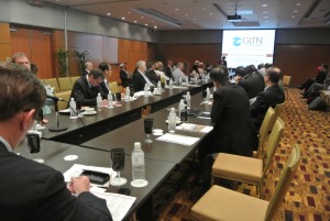
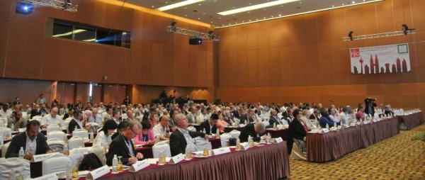
FIG Director Generals Forum was well attended with Director/Surveyor
Generals from all over the world |
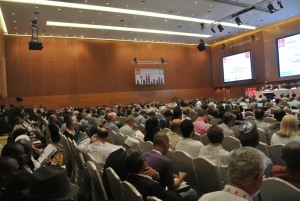
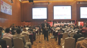
A technical session
|
16th International Surveyors’ Congress (16th ISC)
As part of the FIG Congress the Royal Institution of Surveyors Malaysia
held their 16th International Surveyors’ Congress (16th ISC) on the last two
conference days. The ISC is an annual event and around 160 participated in
the congress. The technical programme was included in the overall congress
programme. There was however a special opening ceremony on Thursday 19 June.
The incoming President Welcome Address: Sr Hasan Jamil, Deputy Director
General II, Departm. of Survey and Mapping Malaysia, also co-congress
director of the FIG Congress gave a welcome address. Hereafter Sr P. Tangga
Peragasam, RISM President and Cheehai Teo, FIG President gave a welcome
speech and finally Louise Brooke-Smith, RICS President Elect and Prof. Jon
Mills, Treasurer of ISPRS both gave a Keynote Address.
Young Surveyors Conference
The Young Surveyors had their own successful Conference in a hotel next
door and had furthermore access to the full congress programme as well. The
atmosphere was dynamic, interactive and with a focus to documentation via
social media. Eva-Maria Unger from Austria presented the results of this
event to the general assembly of FIG: ‘Yes we are the future and we are
dreaming big’. During the three conference days there were both plenary
sessions with many high level speakers as well as several workshops. 180
Young Surveyors had found their way to the FIG Congress.
FIG Foundation had through a competition selected 8 Young Surveyors from
various parts of the world to attend the full congress. These young
surveyors presented their papers in a special session on their thoughts and
visions for the future.
Young Surveyors from the Asia/Pacific area also held their first regional
meeting during the congress.
Training of Trainers Workshop
Prior the conference a 3½ day workshop was held for young surveyors on
the training of the Social Tenure Domain Model (STDM) use and application.
The workshop was organised jointly between UN-Habitat/GLTN and FIG Young
Surveyors Network. Around 30 Young Surveyors as well as civil society and
grassroots organisation partners participated in the workshop.
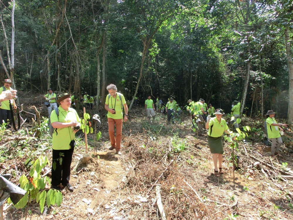
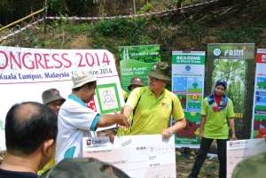
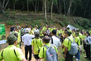
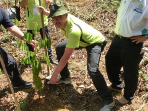
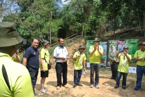
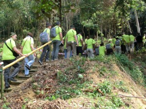
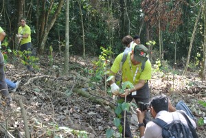
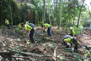
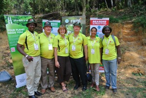
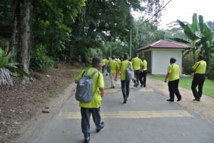
Carbon Offset Tour
Presidents and Heads of delegations of FIG member associations were
invited into the jungle of Malaysia during the technical programme to plant
100 trees on behalf of the Congress. This programme is initiated by the
Malaysian Convention and Exhibition Bureau, MyCEB in line with the Prime
Minister's commitment to offset 40% carbon emissions by year 2020. FIG XXV
Congress donated RM 5000 to this programme to secure the sustainability.
The event was set up by president Azmi Mohd Zin of Pejuta, the
Association of Authorised Land Surveyors Malaysia, and his fellow member of
the Local Organising Committee of the FIG Congress together with the Forest
Research Institute Malaysia (FRIM) and took place at FRIM grounds, adjacent
to the Botanical Garden on the outskirts of Kuala Lumpur. All delegates
received a special green shirt to wear during the tour together with a hat
to protect from the sun.
FIG Vice President Rudolf Staiger together with president Azmi unveiled a
plaque commemorating this special event and handed over a cheque from the
Congress to FRIM.
The 100 trees were various heavy hardwood trees that were planted at Field
10, Jalan Rahman Ali, FRIM.
The planting of the trees was followed by a traditional Malaysian lunch
in the Botanical Garden, before the delegates returned to the Kuala Lumpur
Convention Center.
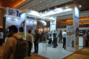
Exhibition
56 international and national exhibitors found their way to the three-day
exhibition and the hall was packed with participants during the breaks
between the sessions but also in-between. A new feature, the Bunga Raya
Platform, was allocated in the exhibition area for technical/product
presentations, briefings or launchings and throughout the day there were
various presentations by the exhibitors.
All coffee/tea breaks and the delicious lunches that the Kuala Lumpur
Convention centre serves took place in the exhibition hall which gave a
lively atmosphere.
After the opening ceremony the Prime Minister of Malaysia officially
opened the exhibition. He walked through the exhibition together with the
Presidents of FIG and the local association PEJUTA. Here, he showed his
interest in the surveying field by the many conversations he had with
various exhibitors.
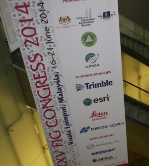
A special thanks to the four platinum sponsors: Trimble, ESRI, Leica
Geosystems and Topcon/Soccia.
Thanks to the silver sponsors: Thomson Reuters, Intermap and Airbus Defence
& Space. Without the support from the sponsors and exhibitors the congress
could not have taken place.
|
The Prime Minister of Malaysia opened the exhibition and showed his
interest in the surveying industry by asking many questions. Here he
is talking with ESRI representative Brent Jones together with FIG
President CheeHai Teo. |
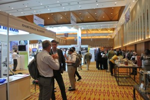
The exhibition hall
|
Technical Tours
During the four congress days various technical tours were offered and
they were all booked up. There were tours to:
- Putrajaya, located 25 km south of Kuala Lumpur that serves as the
federal administrative centre of Malaysia and is managed by Putrajaya
Corporation. Putrajaya is being developed as a City in a Garden.
- The National Valuation Institute (Inspen), a training and research
institute under the Department of Valuation and Property Management
Malaysia (DVPMM) set up to provide capacity building for government
valuers and the property industry. Its main training Campus is located
in Bangi, Selangor about 27 km from Kuala Lumpur City Centre.
- MY Rapid Transit (also known as Klang Valley Mass Transit or MRT) a
proposed 3-line mass rapid transit system in the Greater Kuala Lumpur
(part of Klang Valley region) conurbation which envisages a ‘Wheel and
Spoke’ concept comprising two northeast – southwest radial lines and one
circle line looping around Kuala Lumpur city.
- The Department of Survey and Mapping Malaysia or better known as
JUPEM is responsible for spearheading national development and offers
advisory services to the Malaysian Government in the surveying and
mapping discipline, while undertaking surveying and mapping works
(cadastral surveys, topographical mapping, thematic mapping, underground
utility mapping and boundary demarcartion) which form the foundation of
basic socio-economic development and national sovereignty.
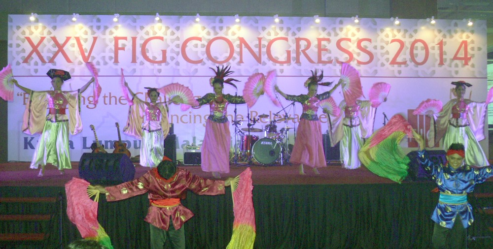
Social Events
The FIG Congress is also about networking, meeting old acquaintances and
meeting new friends and colleagues from all over the world. The Welcome
Reception was an excellent occasion to meet and greet in nice surroundings
at Kuala Lumpur Convention Center.
|
 |
 |
Accompanying persons were offered a special full day tour designed for
them in Kuala Lumpur and surroundings.
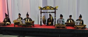
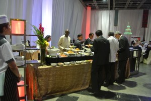
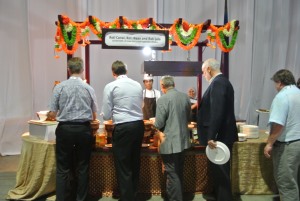
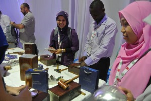
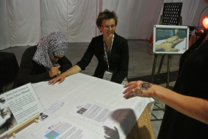
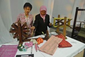
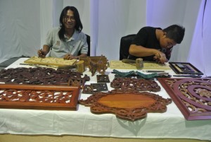
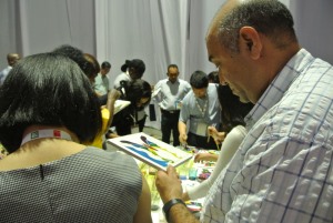
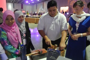
The Malaysian Evening/Foundation dinner was a cultural experience with
Malaysian food, music and art&crafts. The cooks gave explanations to the
various food that was placed at stations around the hall, and in-between the
guests could walk around and make their own various crafts such as batik
paintings, songket weaving, pewter smithing and henna art painting.
|
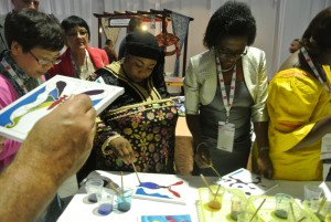 |
President of FIG Foundation John Hohol and Keith Hofgartner, Trimble
greeting all to the Malaysian dinner. Participants could try various
arts & crafts and a malaysian drum band played local music.
|
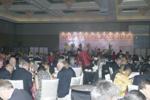
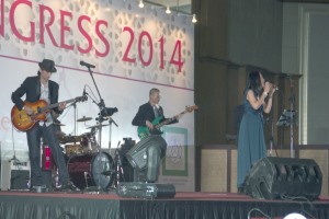
The Gala dinner consisted of a 10 course dinner with a variety of
entertainment during the evening both by a virtuous violin performer, a
local cultural group and finally a live band. The international
participation on the dance floor increased towards the end of the evening.
Conclusion
The FIG General Assembly and its decisions is described in a separate
report.
The Congress finished with a closing ceremony in which FIG President Teo
summarised the main outcomes of the congress and of the last four years. He
described from the vision: “A Profession, armed with knowledge and best
practices, extending the usefulness of surveying for the benefit of society,
environment and economy, increasingly positioned in significance and
relevance, next door to everywhere”, how membership has been engaged, how
FIG has been engaging the global challenge in order to enhance the
significance and relevance towards the betterment.
At the closing ceremony President Teo was acknowledged for the successful
congress together with the local organising committee, represented by
President of PEJUTA, Mohammad Azmi Mohd Zin and Co-congress director Sr
Hasan Jamil.
President Teo was also recognised for his leadership and strong
commitment to the Federation. President Teo will conclude his term of office
by the end of 2014.
FIG thanks all the many participants for their active participation
throughout the Congress; in the many sessions; at the various activities;
around the Convention Centre and it is our hope that the congress does not
stop here – but that all learnings, inspirations and connections are brought
back home for future inspiration.
The next FIG Conference will be the FIG Working Week 2015 in Sofia,
Bulgaria, 17-20 May 2015.
Goodbye form the local organising committee
Links
Key note presentations
Opening ceremony:
Plenary session 1
- Hon. Dato’ Sri Mustapa Mohamed, Minister of International Trade
and Industry, Malaysia
[bio]
[handouts]
- Mr. Gregory Scott, GGIM Advisor, Statistics Division, United Nations
Department of Economic and Social Affairs, United States
[bio] [handouts]
- Dr. Clarissa Agustinus, Global Land Tool Network, UN-Habitat, Kenya
[bio] [handouts]
Plenary session 2
- Mr. Paul Munro-Faure, Deputy Director, Climate, Energy and Tenure
Division, Natural Resources Management and Environment Department, Food and
Agriculture Organization of the United Nations, Italy
[bio]
[handouts]
- Mr. Keith C. Bell, and Mr. Klaus Deininger, The World Bank,
Sustainable Development Department Social, Environment & Rural Development
(EASER), East Asia Pacific Region, United States
[bio] [handouts]
- Prof. Chris Rizos, President, International Association of Geodesy
(IAG), Australia
[bio] [handouts]
Plenary session 3
- Mr. Ben Elder, IPMS Coalition, United Kingdom (Global Launch of
the International Property Management Standards)
[bio] [handouts]
- Mr. Jean-Yves Pirlot
President, Comité de Liaison des Géomètres Européens (CLGE), Belgium
[bio] [handouts]
- Mr. Ahmad Fauzi Nordin, Director General, Department of Survey and
Mapping Malaysia
[bio] [handouts]
Plenary session 4
- Dr. Vanessa Lawrence, Co-Chair UN-GGIM, Ordnance Survey
International, United Kingdom
[bio] [handouts]
- Mr. Mustapha Iptes, Director, International Hydrographic
Organization, Monaco
[bio] [handouts]
- Mr. David Mitchell
[bio] [handouts]
Closing ceremony
Young Surveyors
Further photos (a photo gallery will be posted later)
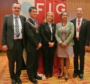
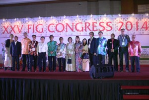
Current and incoming council |
|
ACCO - current and incoming commission chairs |
Exhibition wall |
 |
 |
| General Assembly |
|
 |
 |
Several votings took place during the General Assembly. Here Angel
Yanikiev carries out the voting bowl for counting |
| Opening Ceremony |
|
Malaysian drummers at the opening ceremony |

Participants at the opening ceremony |
|
|
|
| Carbon offset tour |
|
 |
 |
 |
 |
 |
 |
 |
 |
 |
 |
 |
 |
| Exhibition |
|
 |
|
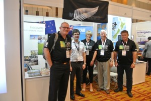
New Zealand stand |
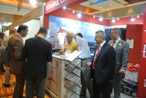
Activity at the Turkish stand |
| Malaysian/Foundation Dinner |
|
|
|
 |
 |
 |
 |
 |
 |
|
 |
 |
| |
|
| Gala Dinner |
|
 |
 |
 |
 |
Local Organising Committee |
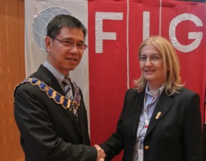
FIG President Teo greeting Incoming President Chryssy Potsiou |
 |