UN-ECA CODI III Conference in Addis Ababa
Dr. Reinfried Mansberger, Vice-Chair of Administration of FIG
Commission 3 (Spatial Information Management), presented FIG as an
observer at the 3rd Meeting of the Committee on Development Information
(CODI) of the UN Economic Commission for Africa (UN/ECA) at UN Conference
Centre, Addis Ababa May 12-16, 2003.
|
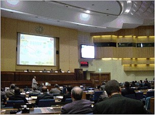
Plenary Conference Room of UNCC. |
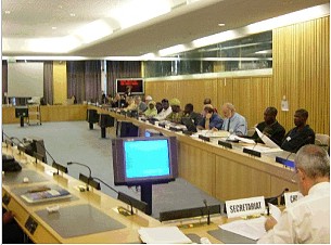
Meeting of the Subcommittee “Geoinformation”. |
The Committee on Development Information (CODI) is one of the seven
subsidiary bodies of the Commission for Africa, established in 1997 by the
23rd Meeting of the Conference of African Ministers responsible for Economic
and Social Development and Planning. As a subsidiary body of the Commission,
CODI provides policy and technical guidance for the sub-programme
“harnessing information for development”. The Development Information
Services Division (DISD) is responsible for implementing this sub-programme
which covers information and communication technologies; statistical
development; database development and management; geo-information and
library, documentation and information services.
The meeting of the Committee was attended by approximately 300 delegates
from almost 45 African countries and by about 100 observers of several
institutions that are not members of the Commission, but also with a
professional focus on matters of development information.
The Committee meets every two years, organising its work in plenary
meetings and in three subcommittees for
- Information and communication technologies (ICT);
- Statistics (STAT), and
- Geoinformation (GEO).
Reinfried Mansberger presented a paper in a plenary session with the
title “Geoinformation to Support Decentralization and Community Empowerment”
(paper and ppt-files of the presentation available on the FIG web site and
Commission 3 website). This presentation can also be downloaded from the
CODI III-homepage (http://www.uneca.org/codi/codi3docs.htm)
in English and French language.
The FIG representative also participated in a pre-conference symposium on
“Establishing Permanent Committee on SDI, incorporating AFREF (African
Geodetic Reference Frame)”. He further attended all plenary sessions and the
sessions of the Subcommittee “Geoinformation”. This subcommittee session was
attended by delegates from 23 African member states and by 40 observers.
A one-day sightseeing tour, together with the Prof. John Trinder,
President of ISPRS and Prof. Bengt Rystedt, President of ICA was used
to exchange experiences and to discuss actual challenges for our profession.
|
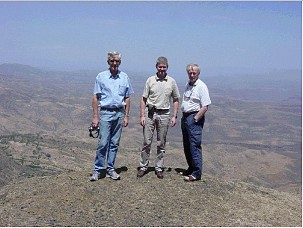
Representatives of ISPRS (John Trinder), FIG (Reinfried Mansberger) and
ICA (Bengt Rystedt) during a field trip to the Blue Nile Gorge. |
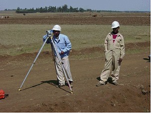
Ethiopian colleagues levelling for a (Japanese financed) road project in
the Ethiopian highlands. |
Reinfried Mansberger also used the visit at the conference to promote the
2nd FIG Regional Conference and 10th Anniversary of ONIGT “Urban-Rural
Interrelationship for Sustainable Environment” (Marrakech, Morocco, December
2-5, 2003) and to discuss some organisational issues with the Secretary
General of the Local Organising Committee, Prof. Mohamed Timoulali.
At the meeting of the Subcommittee on Geoinformation (CODI-GEO) Kenya was
elected as chair, Morocco as vice-chair and Congo as rapporteur for the next
two years (2003-2005).
Following results and recommendations were adopted by CODI-GEO:
- Geoinformation is crucial for good governance and should be made
readily accessible to governments and communities.
- The way geoinformation is presented makes it appear too technical and
thus it is not understood and appreciated.
- Many African countries have made achievements in the establishment of
NSDI, but there are still many countries with little progress in this
respect.
- Fundamental datasets are a crucial component of SDI, but these are
missing in most African countries.
- To include the functions of a Permanent Committee on SDI for Africa by
expanding the terms of Reference of CODI-GEO.
- National agencies as producers of geoinformation should give priority
to digitise their analogue spatial data holdings.
- Governments should recognize GI production as an investment and as a
national asset and, therefore, should increase the allocation of funds in
their national budgets.
- All three CODI-subcommittees (ITC, STAT, GEO) should undertake at
national level concerted actions and work together in order to sensitise
and educate policy-makers of the benefits and value of information for
development and good governance.
- First Announcement of 2nd Regional FIG Conference in Marrakech was
distributed amongst participants of CODI-GEO session.
In informal meetings concerns about the African situation of the
education of academic education were raised. For example, Prof. Heinz
Rüther, University of Cape Town, South Africa, was interested in the
establishment of an African Education Group. At the moment Prof. Rüther is
the only academic professor on surveying on the African continent. He
requested support from FIG, ISPRS and ICA to promote academic surveying
education in Africa.
More information:
Reinfried Mansberger
Vice Chair on Administration, FIG Commission 3
Email:
mansberger@boku.ac.at
|


