News in 2014

|
Fourth Session of the United Nations Committee of Experts on
Global Geospatial Information Management
6 – 8 August 2014, United Nations Headquarters in New York
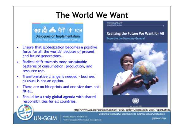
“The many environmental, developmental and humanitarian challenges we
are facing today, make it increasingly apparent that location matters. Thus,
geospatial information is fundamental to decision making, policy
formulation, measuring and monitoring development elements, all critical to
the post 2015 development agenda. I encourage you to remain continuously
engaged and provide your expert advice for all the processes mentioned above.”
Mr. WU HongBo,
Under-Secretary General for Economic and Social Affairs,
United Nations
(6th August 2014)
Source: Greg Scott, UN-GGIM, June 2014
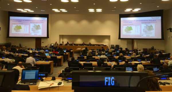
The Fourth Session of the United Nations Committee of Experts on Global
Geospatial Information Management (UN-GGIM) was held from 6-8 August 2014 at
the United Nations Headquarters in New York. The Fourth Session brought
together senior executives from national geospatial information authorities
within Member States, and international geospatial experts from across the
globe. The United Nations Economic and Social Council (ECOSOC) established
the United Nations Committee of Experts on Global Geospatial Information
Management (UN-GGIM) in July 2011 (ECOSOC resolution 2011/24) as the
official United Nations intergovernmental consultative mechanism on global
geospatial information management.
The main objectives of the UN-GGIM are to provide a forum for
coordination and dialogue among Member States, and between Member States and
relevant international organizations and to propose work-plans and
guidelines with a view to promoting common principles, policies, methods,
mechanisms and standards for the interoperability and inter-changeability of
geospatial data and services.
In his opening remarks, Mr. WU HongBo, the United Nations
Under-Secretary General for Economic and Social Affairs and
Secretary-General of the International Conference on Small Island
Development States said that “One of the key objectives of the Committee
of Experts is to contribute to the United Nations post 2015 development
agenda. In this context, I wish to mention to you a number of ongoing
initiatives and programmes at the United Nations which invariably provide
excellent opportunities to reflect on the important supporting role that the
global geospatial community can play for the sustainable development agenda.
The second meeting of the High-Level Political Forum on Sustainable
Development was held here in New York just recently in July, under the theme
of achieving the Millennium Development Goals and charting the way for an
ambitious post-2015 development agenda. The Open Working Group on
Sustainable Development has just concluded its work and so will the
Intergovernmental Committee of Experts on Sustainable Development Financing.
Both processes will provide key inputs to the formulation of a new United
Nations development agenda beyond 2015, with sustainable development at its
core. Next month, the United Nations will organize its Third International
Conference on Small Island Development States. In the same month the
Secretary General has also invited Heads of State and Government, along with
business, finance, civil society and local leaders, to a Climate Summit here
in New York. The many environmental, developmental and humanitarian
challenges we are facing today, make it increasingly apparent that location
matters. Thus, geospatial information is fundamental to decision making,
policy formulation, measuring and monitoring development elements, all
critical to the post 2015 development agenda. I encourage you to remain
continuously engaged and provide your expert advice for all the processes
mentioned above.”
The deliberations and the outcomes of the Fourth Session further
recognized and underscored the critical role of geospatial information
management and the need for enhanced collaboration and joint initiatives to
advance the development, usefulness and use of geospatial data and tools to
support global sustainable development.
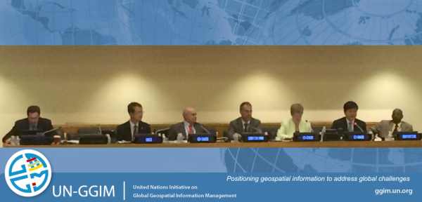
(R-L: 4th Session UNGGIM Bureau & Secretariat: Rapportuer, Mr.
Sultan
Mohammed Alya (Ethiopia); Co-Chair, Dr. LI Pengde (PR China);
Co-Chair Dr. Vanessa Lawrence (UK); Mr. Stefan Schweinfest (UN
Statistics Division); Co-Chair Dr. Edouardo Sojo (Mexico); Mr. Kyoung-soo EOM (UN Cartographic Section); Mr.
Greg Scott (UN
Statistics Division)
A notable outcome from the Fourth Session was the adoption of the draft
resolution on a Global Geodetic Reference Frame for Sustainable Development
and to refer the Resolution to the United Nations Economic and Social
Council for endorsement and further referral to the UN General Assembly.
However the UN-GGIM regretted that the level of understanding and uptake of
geography and geospatial information in sustainable development,
particularly at the policy and decision-making level, as efforts remained
somewhat limited. In this regard, UN-GGIM agreed to establish a small group
of experts to support the Bureau and Secretariat in their efforts to enhance
the role and value of geospatial information in the ongoing debate on
sustainable development and the post-2015 development agenda.
UN-GGIM agreed that actions be taken to work jointly towards the
preparation, improvement and maintenance of fundamental geospatial data
themes building on existing national and regional fundamental themes. The
draft “A Statement of Shared Guiding Principles for Geospatial Information
Management” was agreed as a more appropriate and with strong consensus, the
Working Group where FIG is a member, will refine the statement based on the
interventions by member states for endorsement by UN-GGIM and further
referral to the Economic and Social Council.
Global Forum on the Integration of Statistical and Geospatial
Information, 4th – 5th August 2014, United Nations Headquarters in New York
Preceding the Fourth Session of UN-GGIM was the United Nations Global
Forum on the Integration of Statistical and Geospatial Information. The
United Nations Expert Group on the Integration of Statistical and Geospatial
Information substantively supported the Forum, organized by the United
Nations Statistics Division, acting as the Secretariat for both the UN
Statistical Commission and UN-GGIM. The Global Forum aimed to continue the
global consultation and communication on the development of a global
statistical-geospatial framework, initiated by the UN Statistical Commission
and UN-GGIM. The Forum recognized the necessity to bring together both
statistical and geospatial professional communities, discussed and aimed to
develop strategic goals and better practices towards the integration of
statistical and geospatial information.
The Forum acknowledged that the harmonizing of national statistical and
geospatial systems provides valuable means nationally for the integrating of
diverse data themes including that of socio-economic and environmental data.
There was also the recognition that the upcoming 2020 round of census
provides the opportunity to harmonize these two systems towards the desired
integration of data and the avoidance of duplicative efforts.
Further meetings at UN Headquarter in New York, August 2014:
CheeHai Teo
August 2014
New York
19 August 2014
|


